Cut and fill, from a PDF to a 3D surface.
SiteWorx/OS builds 3D models of the existing site and the proposed grade straight from the contours on your site plans. Calculate cut, fill, and sub-grade volumes, balance the site, and hand the results off to Excel, DWG, CSV, or PDF.

3D models of the existing and proposed site.
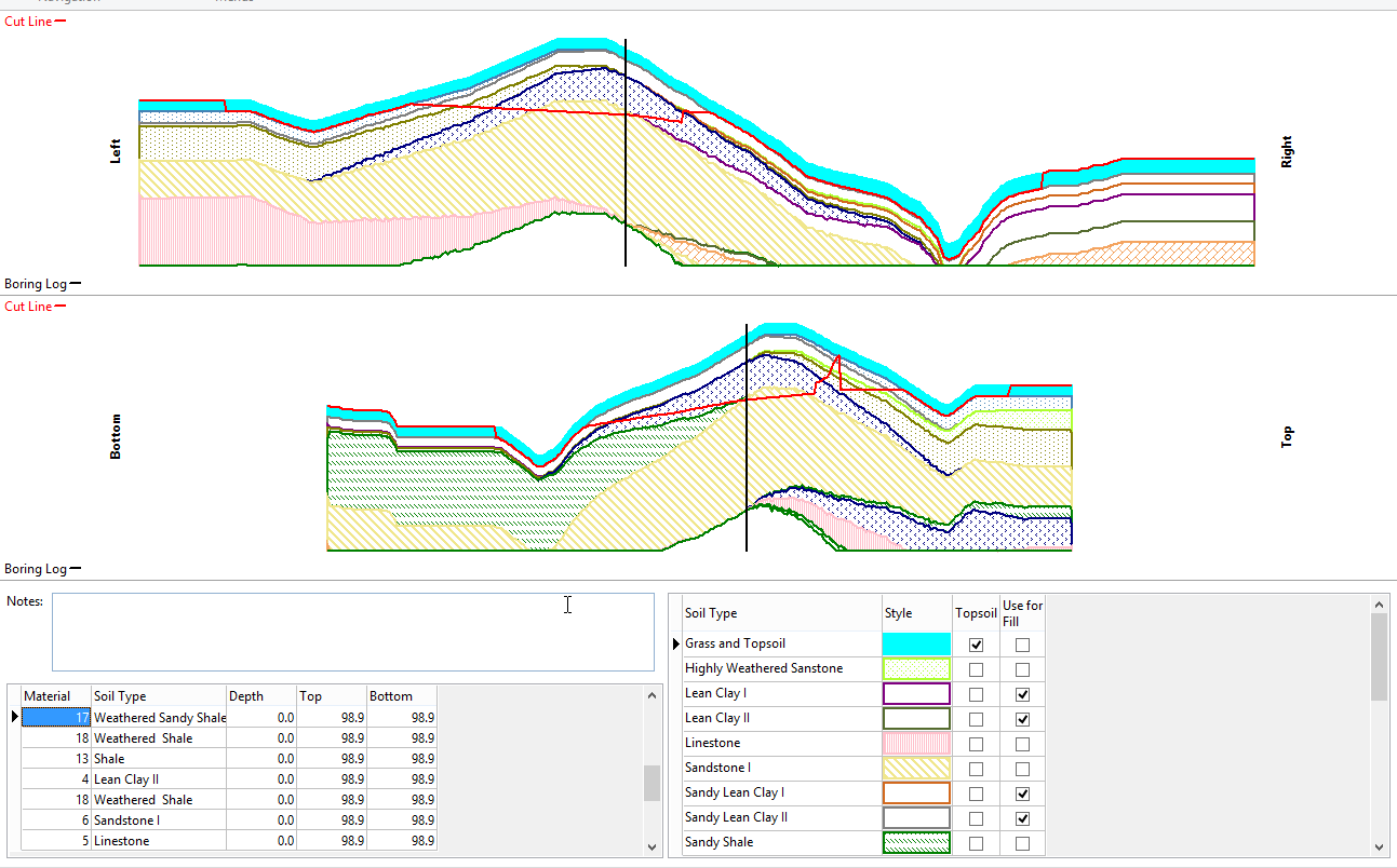
SiteWorx/OS digitizes existing-ground contours and proposed-grade design lines straight from the sheet and builds a 3D model of each. Drop in spot elevations, project boundaries, sloping design lines, and borings as you go.
- Existing and proposed surfaces in one project
- One-click contour takeoff from vector PDF and DWG
- Trace contour lines from raster drawings
- Pick the elevation at any point on the 3D surface
Cut, fill, sub-grade, and trench, all priced.
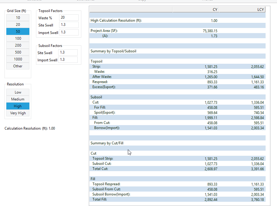
Calculate net earthwork between the existing and proposed surfaces, then break the site into zones to balance the dirt. Sub-grade, over-excavate and backfill, trenches, and topsoil strip and re-spread come out as separate quantities.
- Cut, fill, and sub-grade material volumes
- Over-excavate and backfill volumes computed automatically
- Trench materials and volumes disclosed separately
- Topsoil strip and re-spread, with the option to exclude regions
- Boring log input for cut volumes by soil type
- Site balancing adjustment built in
Hand the takeoff to whoever needs it next.
Push results to Microsoft Excel, Word, or PDF for the bid package. Export the takeoff itself as a DWG, or push GPS surface model points as a CSV or DWG for the field. SiteWorx is cloud storage capable, save the project to any cloud drive.
- Export results to Microsoft Excel, Word, or PDF
- Copy results and paste straight into Excel
- Export the takeoff as a DWG file
- GPS surface model points as CSV or DWG
- Area
- Material Volumes
- Cut / Fill
- Cut / Fill Summary
- Plan Cut / Fill
- Scaled Plan Cut / Fill
- Stake
- Takeoff
- 3D
- Cross Sections
- Topsoil
- Trench Export
Runs on the estimator’s workstation.
- Operating system
- Windows 10 (64 bit)
- Windows 11
- Hardware
- 8 GB RAM (16 GB recommended)
- 1 GB disk space
- Drawing inputs
- PDF (vector and raster), DWG, DXF
- Exports
- Excel, Word, PDF, DWG, CSV
Pay up front, or rent by the year.
Multi-seat crews can add a Concurrent License Manager to share seats across the team , see pricing.
Buy once. Year 1 of Full Serve included.
- All surface + earthwork features
- Year 1 of Full Serve included
- Use on your workstation as long as you license it
- Move the license between machines via the portal
Lower entry price for civil contractors with seasonal earthwork needs. Bundles Full Serve while the rental is active.
- All features for the rental term
- Full Serve bundled while active
- Convert rental to perpetual any time
- Cancel before renewal, no auto charge
Things estimators ask us about SiteWorx/OS.
Full library at /support/faqs. Or step through the manual at /support/training/siteworx-os.
Model your next site in 14 days.
Full feature set unlocked. No credit card. Convert to perpetual or rent whenever the job calls for it.