
Cut and fill, from a PDF to a 3D surface.
Trace the contours off the plan and see how many cubic metres you are moving and what you are carting away, before you tender. Pricing sewer, water or storm drainage? Trench spoil and overburden come off the same plan.
Takeoff and estimating software for quantity surveyors and for excavation, grading, site development and underground utility contractors.
- No CAD
- No survey crew
- No machine control
- A Windows PC and the plan set
- Metric and imperial
$2,999 then $199 a year, or $1,499 a year to rent. Full pricing
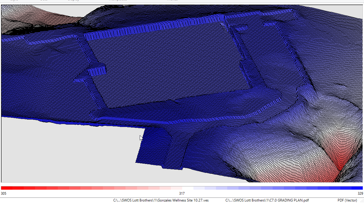
3D models of the existing and proposed site.
SiteWorx/OS digitises existing-ground contours and proposed-level design lines straight from the sheet and builds a 3D model of each. Add spot levels, project boundaries, sloping design lines and boreholes as you go.
- Existing and proposed surfaces in one project
- One-click contour takeoff from vector PDF and DWG
- Trace contour lines from raster drawings
- Pick the elevation at any point on the 3D surface
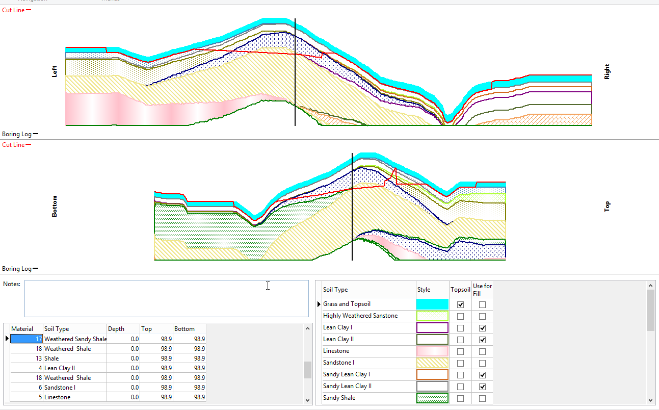
Cut, fill, sub-grade, and trench, all priced.
Calculate net earthwork in m³ between the existing and proposed surfaces, then break the site into zones to balance cut and fill. Sub-grade, over-excavation and backfill, trenches, and topsoil strip and re-spread come out as separate quantities, ready for the BoQ.
- Cut, fill, and sub-grade material volumes
- Over-excavate and backfill volumes computed automatically
- Trench materials and volumes disclosed separately
- Topsoil strip and re-spread, with the option to exclude regions
- Boring log input for cut volumes by soil type
- Site balancing adjustment built in
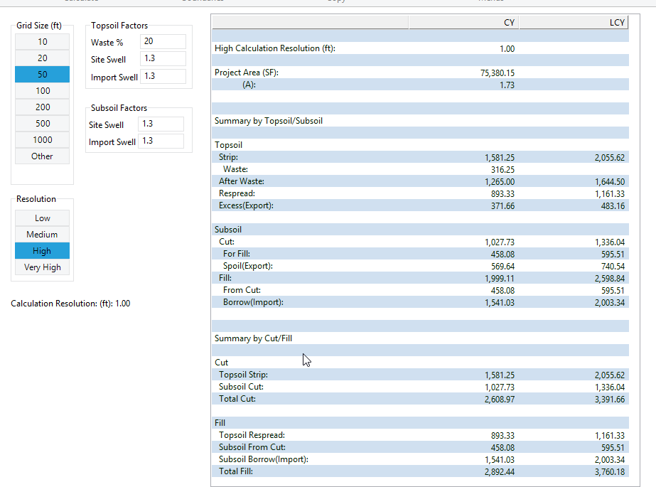
Hand the takeoff to whoever needs it next.
Push results to Microsoft Excel, Word or PDF for the tender package or the BoQ. Export the takeoff itself as a DWG, or send GPS surface model points to site as CSV or DWG. SiteWorx works with cloud storage, so you can save the project to any cloud drive.
- Export results to Microsoft Excel, Word, or PDF
- Copy results and paste straight into Excel
- Export the takeoff as a DWG file
- GPS surface model points as CSV or DWG
- Area
- Material Volumes
- Cut / Fill
- Cut / Fill Summary
- Plan Cut / Fill
- Scaled Plan Cut / Fill
- Stake
- Takeoff
- 3D
- Cross Sections
- Topsoil
- Trench Export
Runs on a standard Windows workstation.
- Operating system
- Windows 10 (64 bit)
- Windows 11
- Hardware
- 8 GB RAM (16 GB recommended)
- 1 GB disk space
- Drawing inputs
- PDF (vector and raster), DWG, DXF
- Exports
- Excel, Word, PDF, DWG, CSV
Pay up front, or rent by the year.
Teams with several seats can add a Concurrent License Manager to share licences across the team, see pricing. Prices are in US dollars.
Year 1 of Full Serve included. $199 a year after that.
- All surface + earthwork features
- Year 1 of Full Serve included
- Use on your workstation as long as you license it
- Move the license between machines via the portal
Lower entry price if you would rather not buy outright. Bundles Full Serve while the rental is active.
- All features for the rental term
- Full Serve bundled while active
- Convert rental to perpetual any time
- Cancel before renewal, no auto charge
Questions QSs and contractors ask about SiteWorx/OS.
Full library at /support/faqs. Or step through the manual at /support/training/siteworx-os.
Model your next site in 14 days.
Full feature set unlocked. No credit card. Convert to perpetual or rent whenever the job calls for it.